A Land Steeped in History: Unveiling the Layers of Time
Journey through time at the mouth of Painkalac Creek. The dramatic cliffs, sculpted by the uplift of ancient rocks 50-150 million years ago when Australia was still joined to Antarctica, hint at a fascinating geological past. Can you believe there was an underwater volcano erupting just offshore 25 million years ago?

Underwater volcano
Proof of this fiery past lies in the iron-streaked basalt (cooled lava) at the cliff’s base.
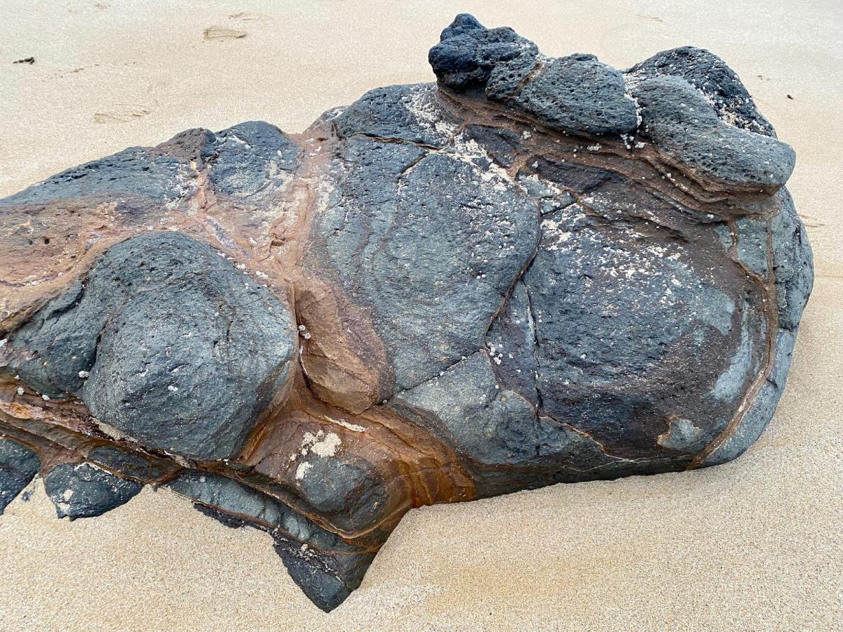
Basalt rock
120,000 years ago the sea levels rose 7.5 metres above its present level and then fell 120 metres around 18,000 years ago during the last Ice Age when sea levels dropped dramatically, and you could walk to Lutruwita/Tasmania. The sandy beach and dunes in front of you were only formed 6000 years ago, when the sea level reached its present level.
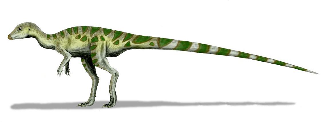
Picture dinosaurs like Leaellynasaura (115 million years ago) and megafauna, giant creatures like the Procoptodon, roaming this area just 50,000 years ago.
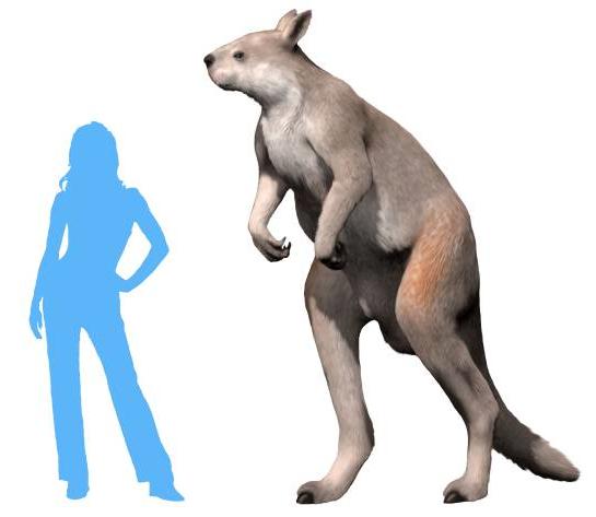
A size comparison of a human and Procoptodon goliah, the largest kangaroo that ever lived (Image by Nobu Tamura CC BY)
Aboriginal Connections: A Legacy of Respect
For over 25,000 years, the Gadabanud and Waddawurrung Peoples have been stewards of this land, witnessing its incredible transformations. Their cultural heritage is woven into the very fabric of this place – middens, ochre pits, burial grounds, fish traps – a testament to their deep connection with this living landscape.
European Arrival and Conservation Efforts
European settlement in 1839 brought significant changes.
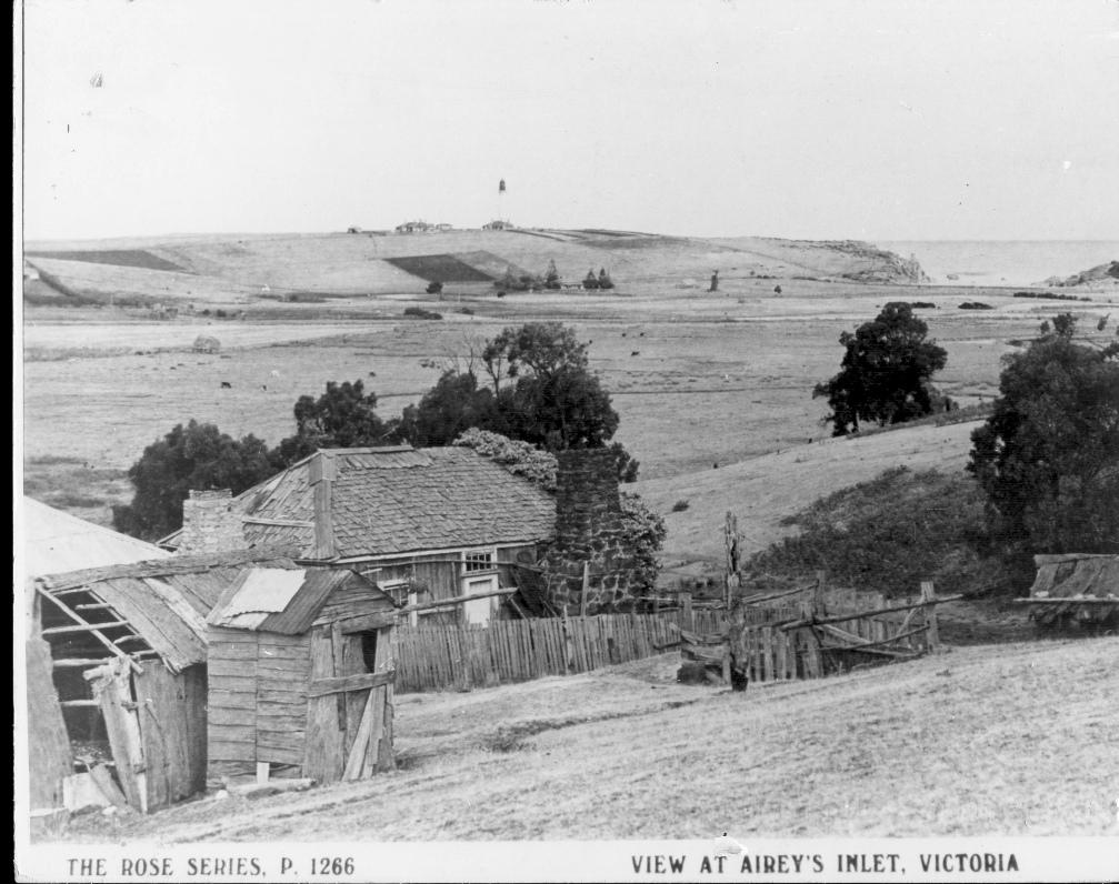
Wybellenna homestead in 1890s (homestead built in 1875) and denuded valley
While agricultural development altered the landscape, flooding ironically protected the vital swamps. Today, revegetation projects, spearheaded by dedicated locals, aim to restore the valley’s once-lost indigenous flora.
Look around and see the difference!
Each patch of thriving vegetation tells a story of resilience and ongoing efforts by groups such as Angair to preserve this remarkable landscape.
Continue on the path to the next sign with a QR code next to the toilet block (number 6 on the map). Walk down to the lookout on the right.
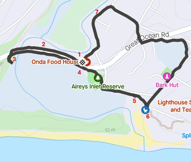
Map of nature walk with interpretive signs marked by numbers