The Painkalac Estuary: A Dance Between Fresh and Salt
Walk down to the lookout on the right.
The Painkalac Estuary, a dynamic 3.5 km waterway where freshwater from Painkalac and Distillery Creeks meets the ocean, plays a vital role in the local ecosystem. Throughout the year, a fascinating seasonal cycle unfolds:
- Summer Sun and Sand: Gentle/low energy summer waves sculpt the coastline, depositing sand that forms a natural barrier across the estuary’s mouth. This closure traps freshwater, creating a haven for wetland plants.
-
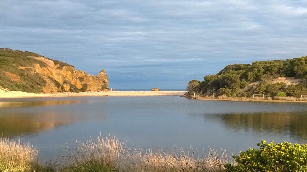
Estuary with sand bar/berm closing entrance
Life-Giving Rains: When the autumn rain arrives, freshwater from Painkalac Creek fills the closed estuary, nourishing the surrounding floodplain vegetation.
- Winter’s Power: As winter storms roll in, powerful waves and increased freshwater flow can breach the sandbar, opening the estuary to the ocean. Exposed mudflats become a feeding ground for a variety of wading birds.
- As water levels increase, flooding of low-lying land and infrastructure can occur. To alleviate flooding risk to human assets, estuary managers artificially open the estuary to allow floodwaters to drain towards the ocean.
-
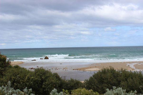
Open entrance
Salty Influx: High tides push saltwater into the estuary, creating a wedge beneath the less dense freshwater. This influx brings in essential nutrients and breeding fish populations.
- The Cycle Continues: As rainfall subsides, the sandbar gradually rebuilds, closing the estuary once more. This remarkable dance between freshwater and saltwater repeats year after year, sustaining a rich tapestry of life within the estuary.
The sand bar at the entrance could be expected to be partially breached naturally a few times per year. However, the reservoir upstream controls the flow of water down the creek and into the estuary changing the natural conditions.

Reservoir wall and spillway
From here walk back along Inlet Crescent northwards past the Bark Hut Reserve where you can read more about settler history in the Bark Hut. Continue through Allen Noble Sanctuary, where there are signs with two QR codes directing you to separate walks that you could explore during this walk or at another time. Walk along the boardwalk back to the Great Ocean Road and turn left along the path. Walk alongside the Great Ocean Road and cross at the traffic island, then walk along River Road and turn left at River Reserve Road back towards the bottom shops. The next sign with a QR code is on the right of the road (number 7 on the map).
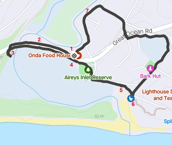
Map of nature walk with interpretive signs marked by numbers