Painkalac Creek Catchment map and characteristics
Painkalac Valley Nature Reserves
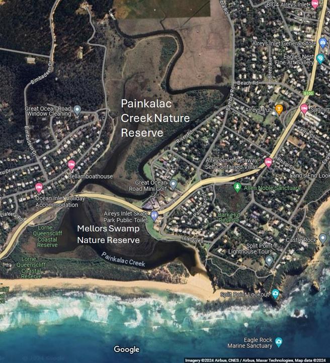 Painkalac Creek Nature Reserve and Mellors Swamp Nature Reserve
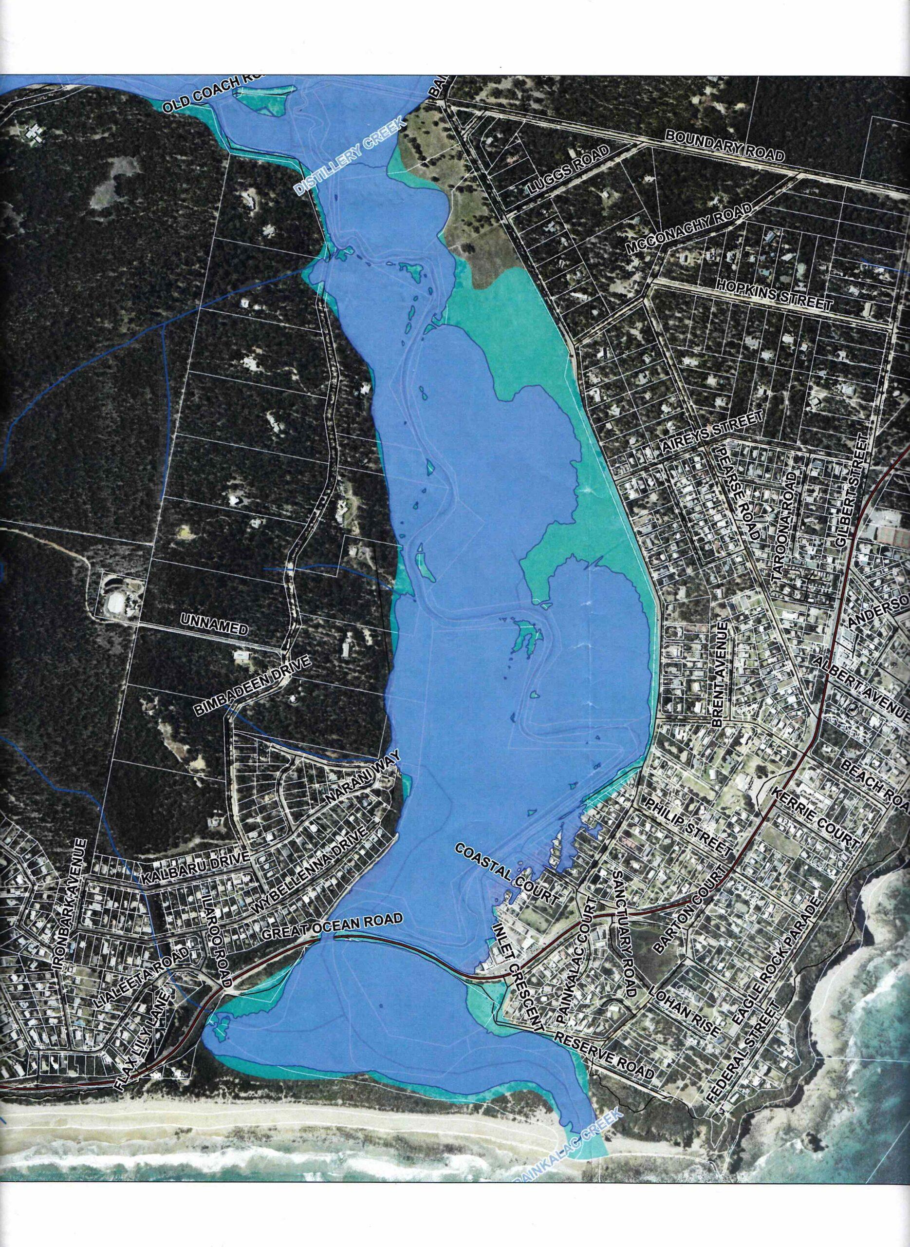
Corangamite Flood Portal: Interactive flood map
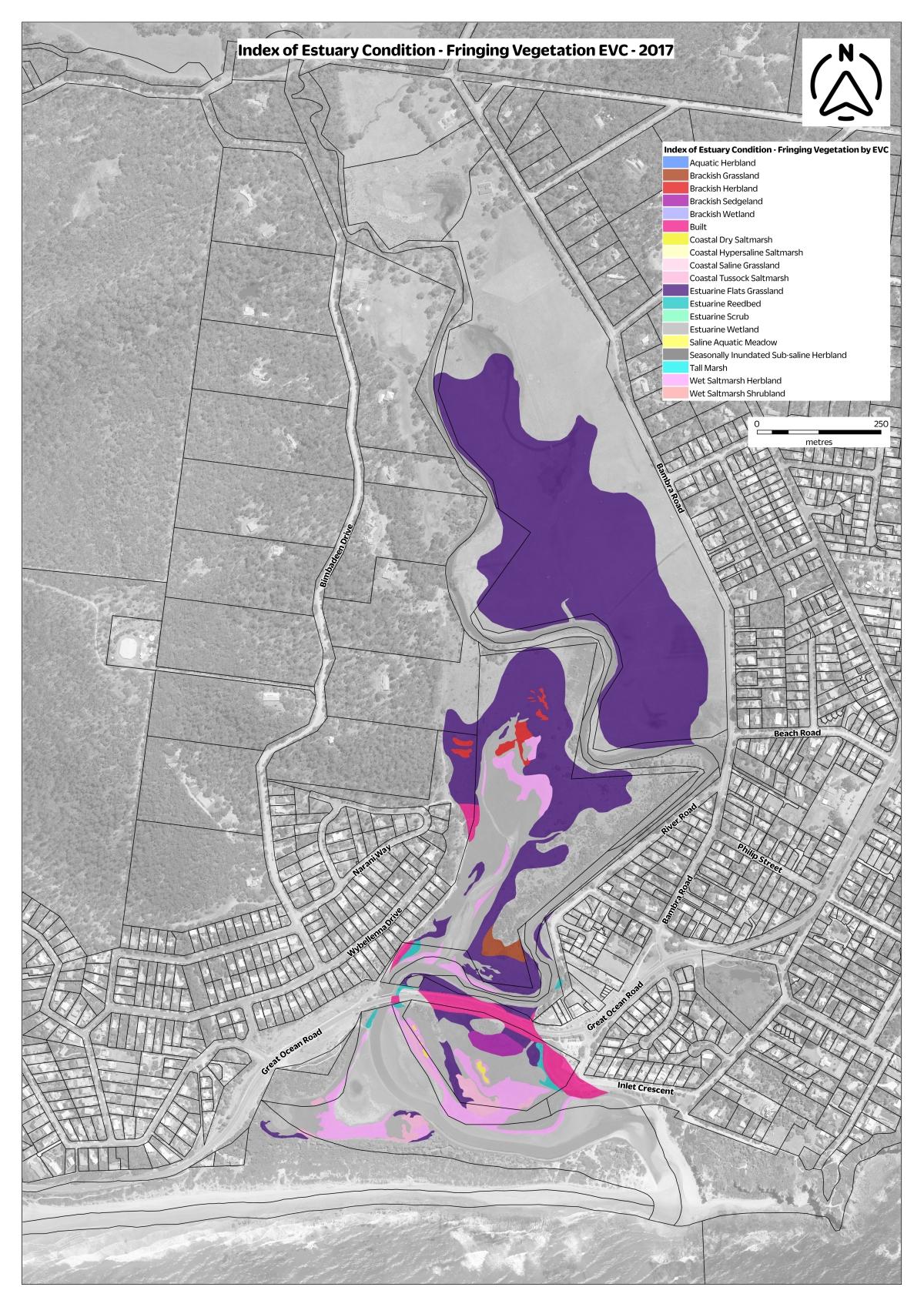
2017 Painkalac Creek Ecological Vegetations Classes (EVC) map
Small version
Original size (note: extremely large file)
2017 Painkalac Valley Conservation areas
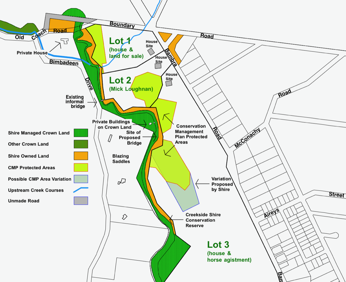
2106 Painkalac Creek Elevation Plan
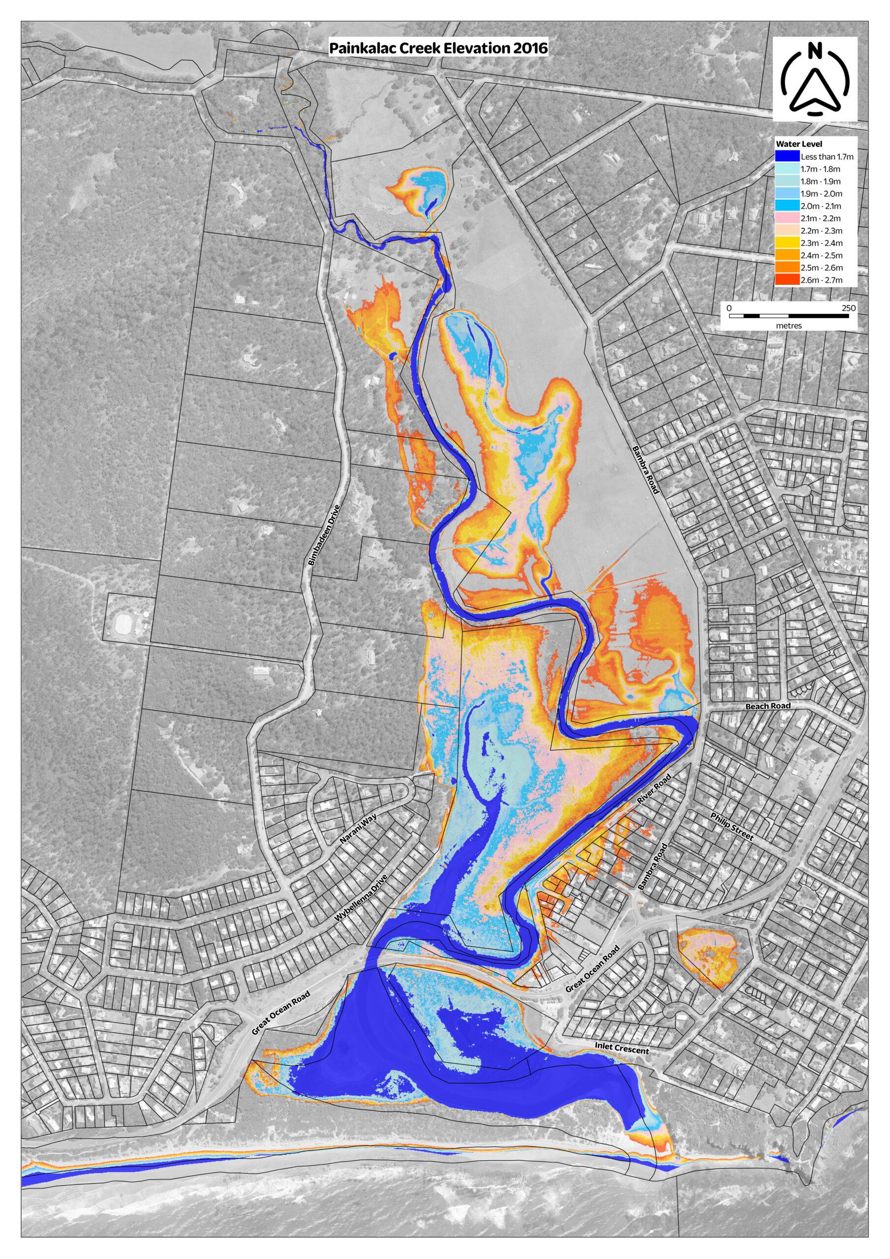
2014 1-100 year flood plan of Painkalac Creek
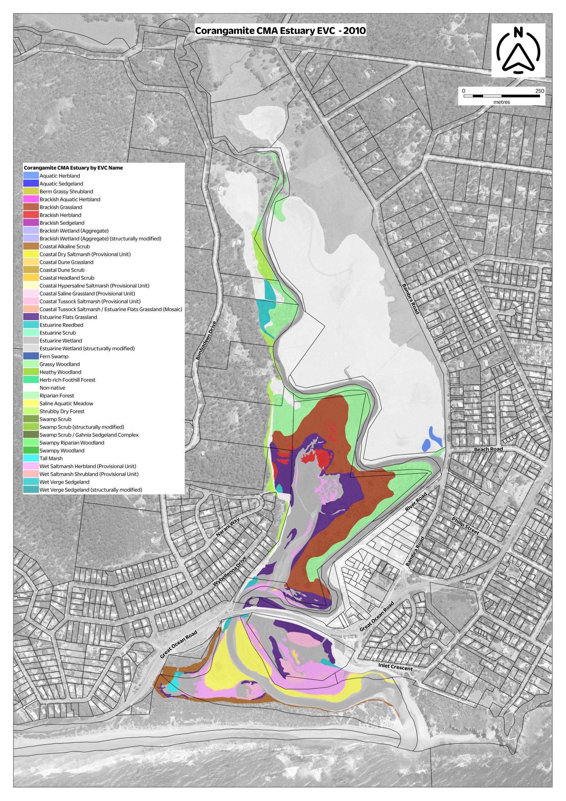
2010 Painkalac Creek Ecological Vegetations Classes (EVC) map
Small version
Original size (note: extremely large file)
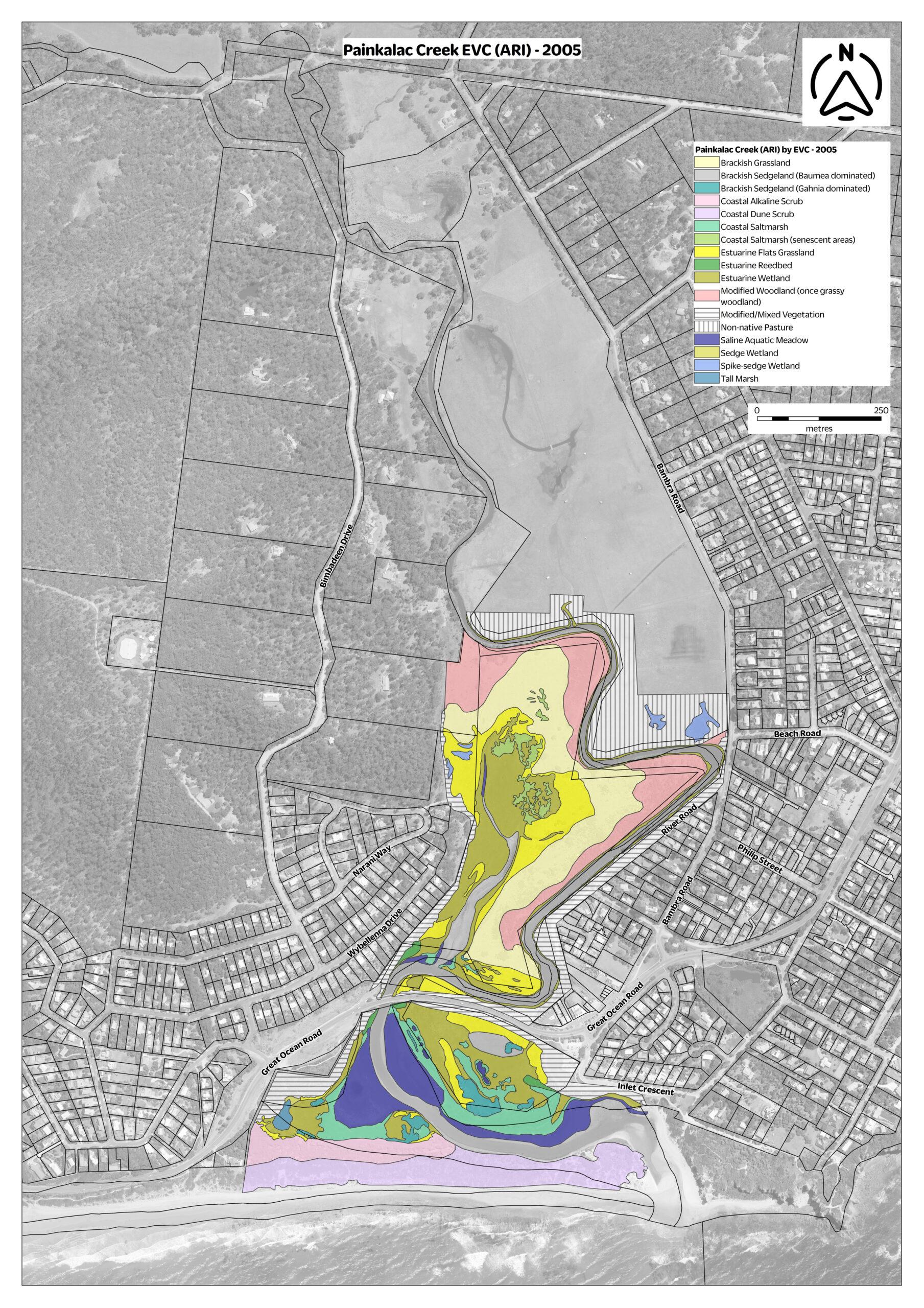
2005 Painkalac Creek Ecological Vegetations Classes (EVC) map
Small version
Original size (note: extremely large file)
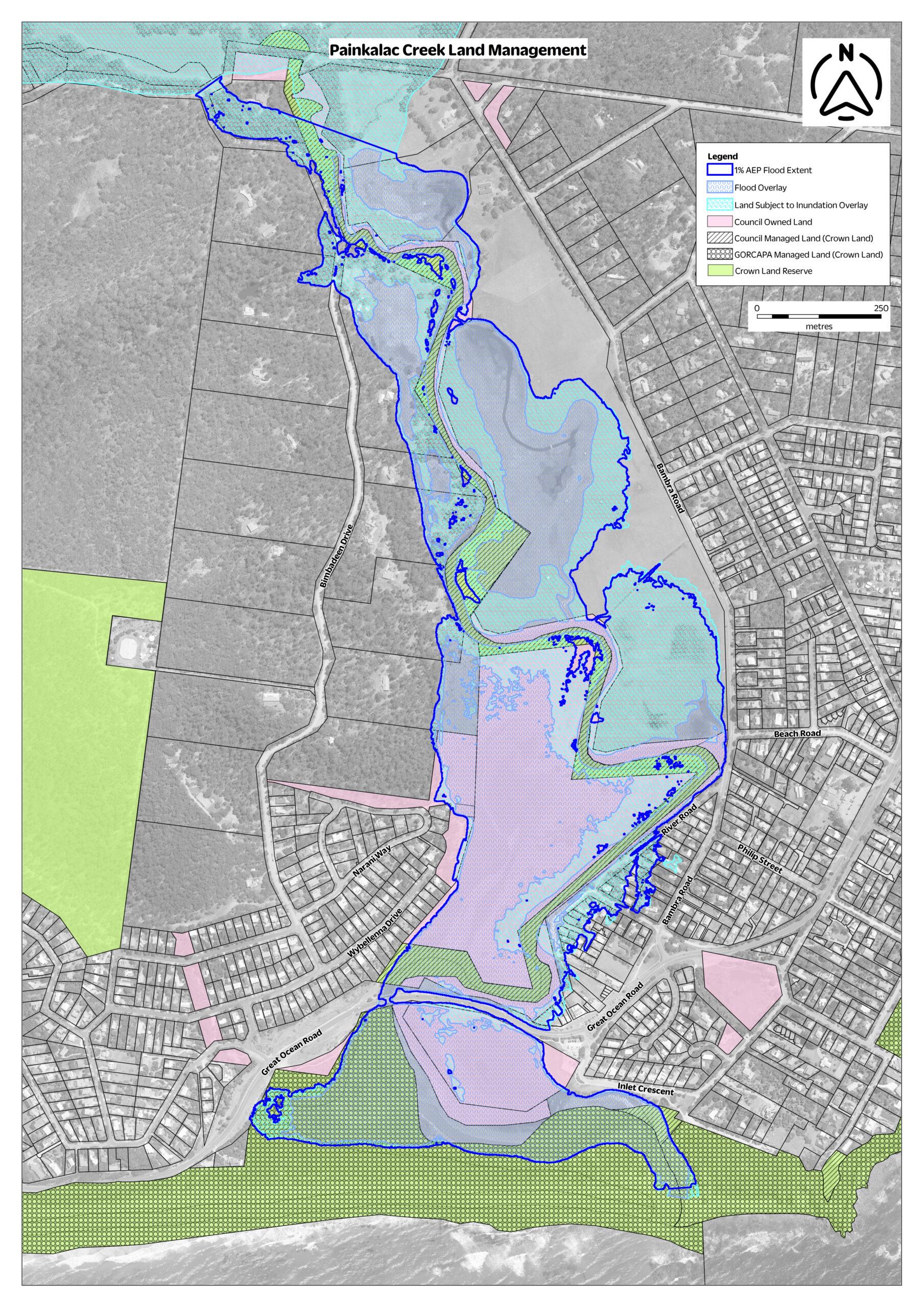
Land management and flood overlay
Small version
Original size (note: extremely large file)
Painkalac Creek Nature Reserve walk
This gentle walk along a gravel track and a wide mown grass track lets you explore this nature reserve containing a mosaic of wetland, grassland and wooded communities. These vegetation types are now threatened along the Surf Coast due to past development along our waterways.
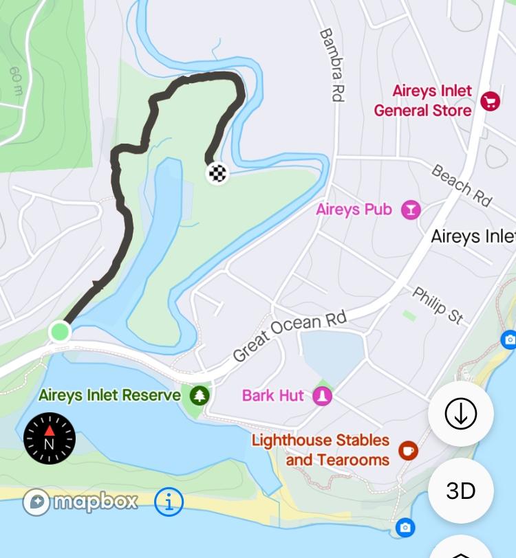
Painkalac Creek Nature Reserve walking track
The walk begins in the carpark on the northern side of the Great Ocean Road next to the bridge crossing the Painkalac Creek. Walk past the gate along the gravel path until you reach the sign providing some details of the Nature Reserve. Continue along the wide mown track to the end which is 1.3 km from the start. Enjoy the variety of flora and fauna that can be seen and return back the way you came to the start of the walk.
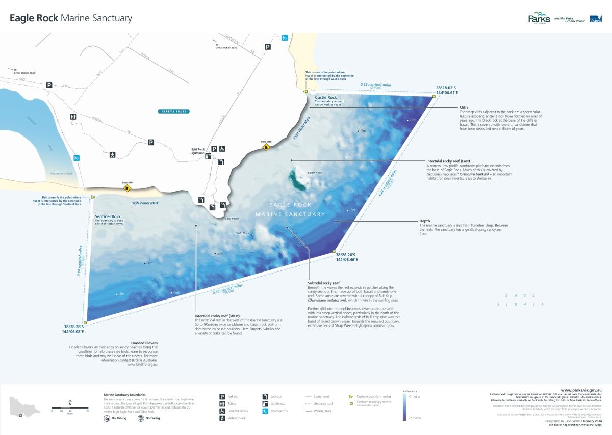
Eagle Rock Marine Sanctuary
Below the lighthouse at Airey’s Inlet is the Eagle Rock Marine Sanctuary (17.9 hectares) which extends from the high-water mark around the base of Split Point between Castle Rock and Sentinel Rock in the township of Aireys Inlet. It extends offshore for about 300 metres and includes the 20-metre-high Eagle Rock a tall volcanic stack capped by limestone, and Table Rock, which has been levelled by the incessant waves.
Eagle Rock Marine Sanctuary