Photos
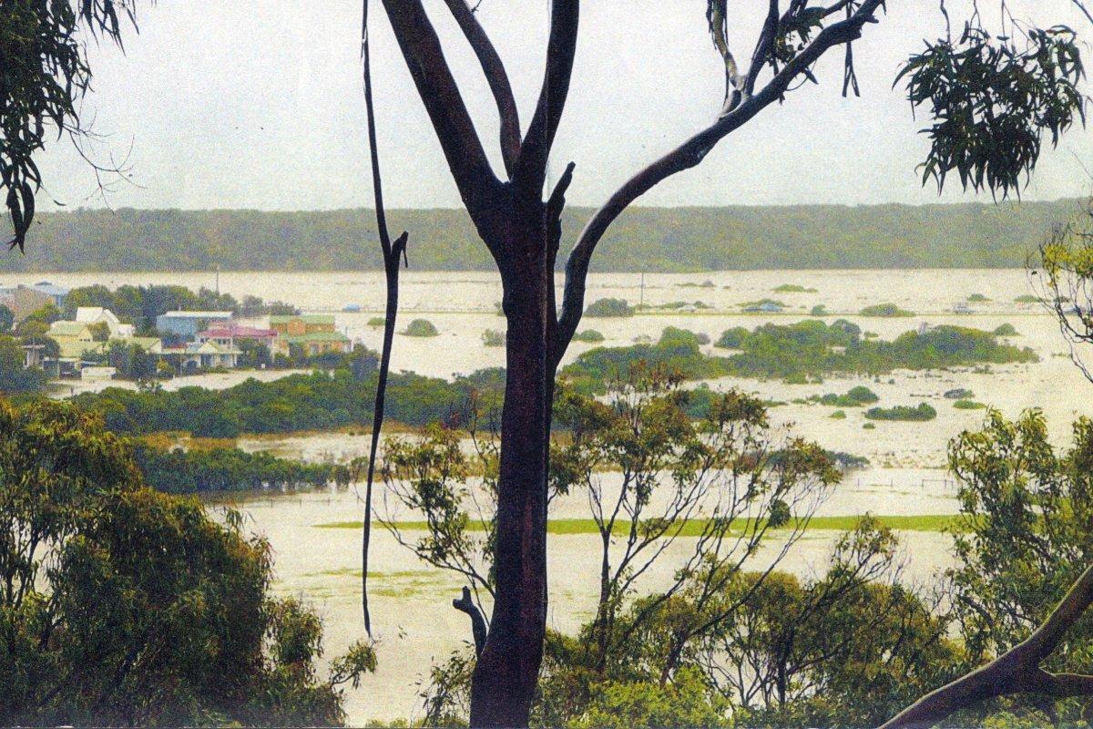
Painkalac Creek in flood 2007 (photo by Roger Ganly)
Maps:
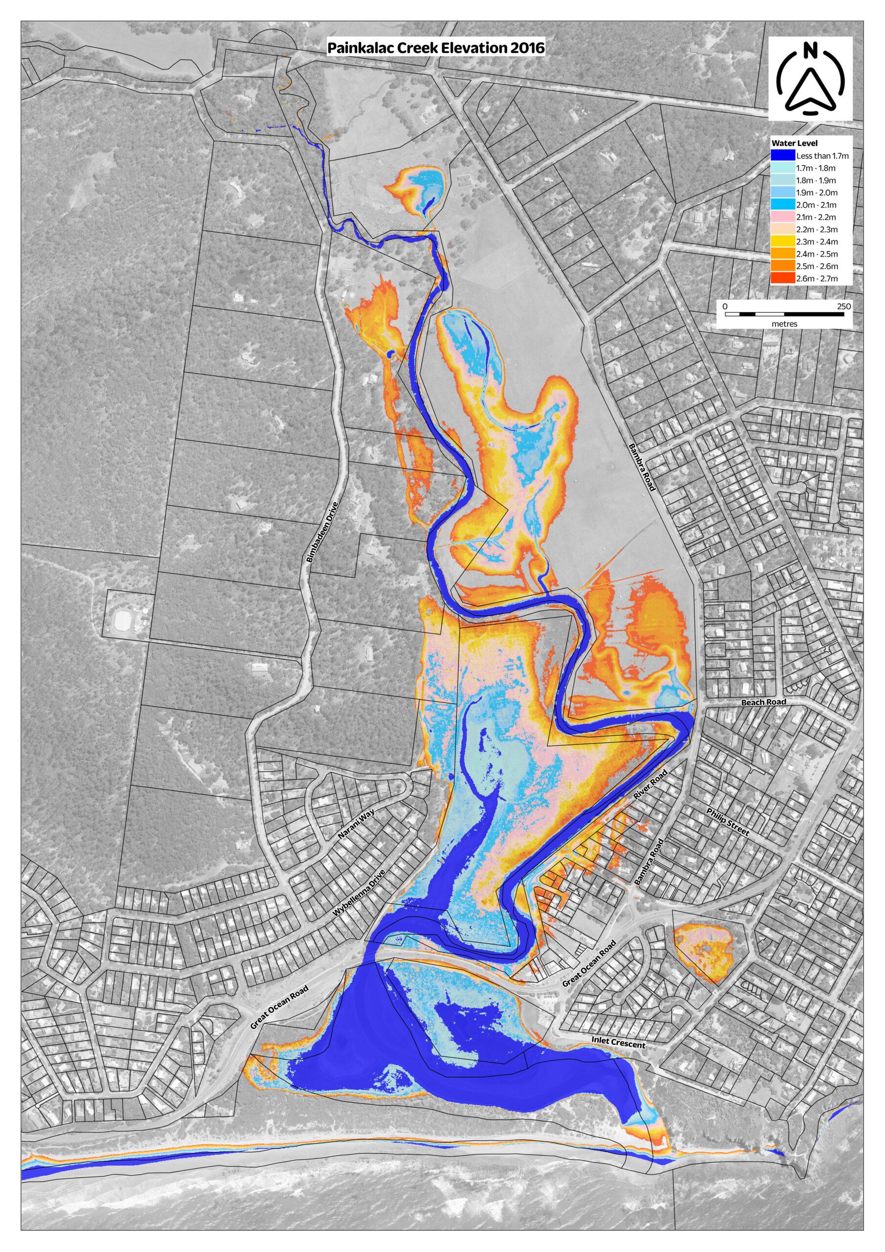
2016 Painkalac Creek Elevation Guide map
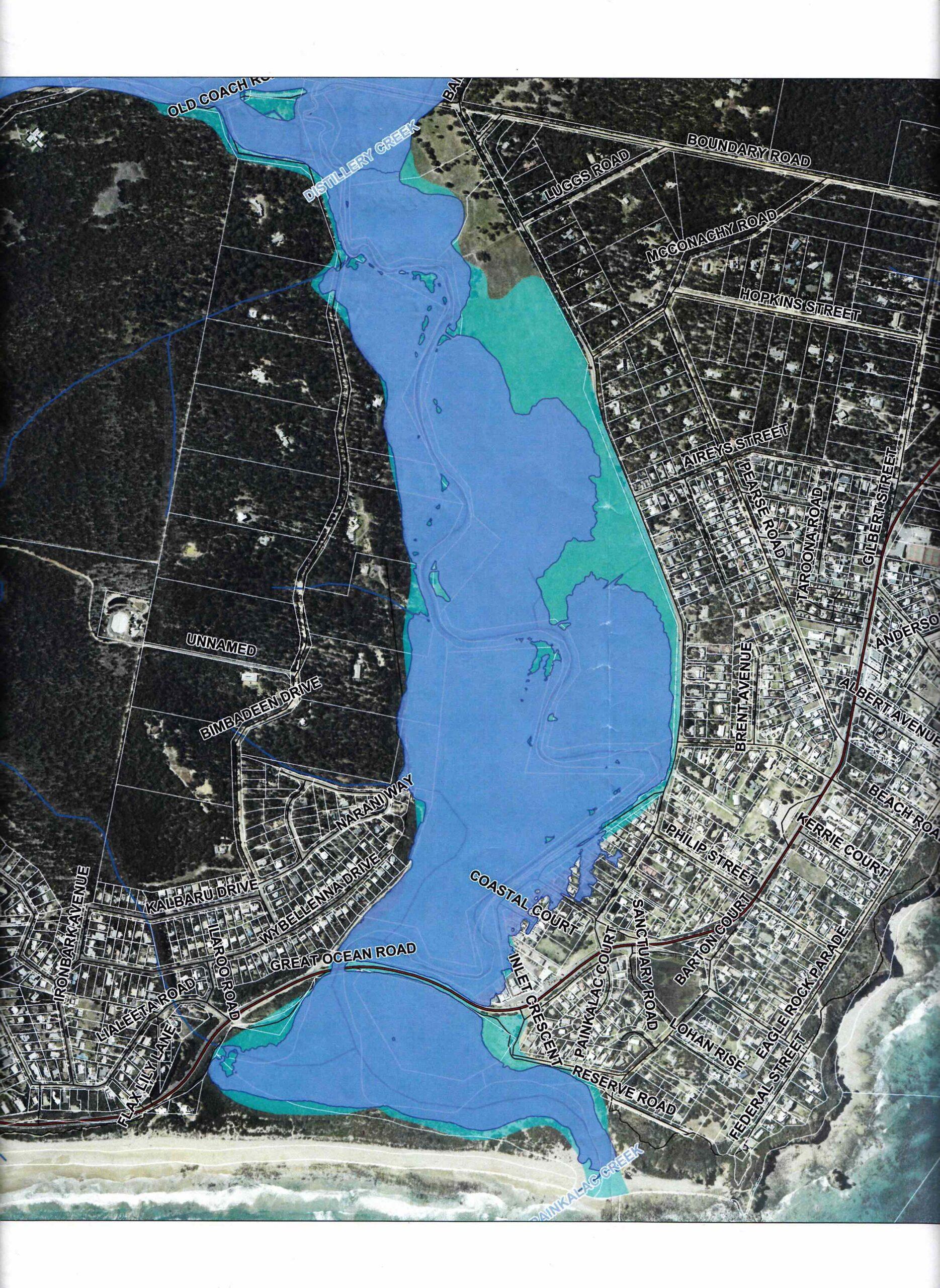
2014 CCMA 1-100 year flood map of Painkalac Creek
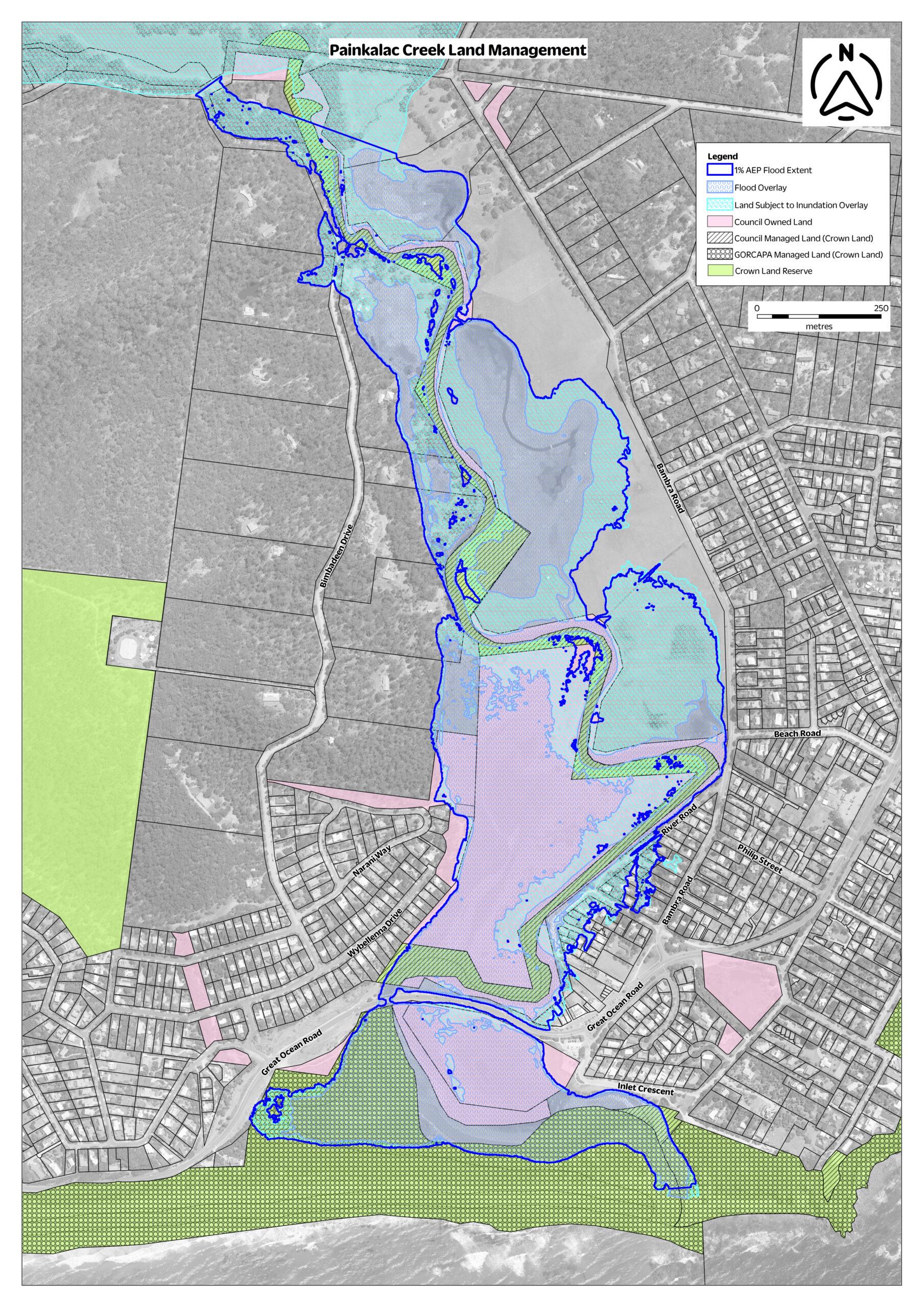
Land management and flood overlay map
Small version
Original size (note: extremely large file)
Documents:
2023 Aireys Inlet Draft Local Flood Guide
2022 Painkalac Creek: Facts on Flooding
2015 CCMA Flood report 23-79 Aireys Inlet
Provides a summary of available flood information for this property. The information relates to inundation that is associated with waterways (riverine flooding) and coastal storm surge only.
2013 Painkalac Creek Flood Study
The Corangamite Catchment Management Authority has completed a detailed hydrological study of Painkalac Creek catchment to determine design flow estimates for the hydraulic floodplain modelling of Airey’s Inlet. This work forms the basis of new flood overlays to be introduced into the Surf Coast Shire Council Planning Scheme.